|

LIZARD
TO CARRICK LÛZ
|
|
From the village green, take the road signposted to
The Lighthouse/ Lizard Point/Car Park. Soon you reach the end
of the houses, the road bends to the left, and a proper footpath
runs parallel to the road. After a pleasant walk, you cross the
road then soon have the choice of walking down the road to Lizard
Point or going to the left towards the Lighthouse; we walked
to the left and then had a nice view of The Point.
|
Housel
Bay from Lizard Lighthouse.... |
|
|
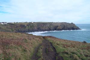
Following the path is easy here, it goes slightly uphill
and then downhill with a wide view of Housel Bay. Eventually,
you reach a narrow stretch followed by steep steps downwards:
Here you can turn right for the beach (a misnomer) or left to
carry on. The path branches, straight on brings you back at Lizard
Village or right for the Coastpath. It's a bit steeper now, levels
out a bit at Housel Bay Hotel, then up again as you skirt the
further side of the Bay.
|
...and
looking back |
|
|
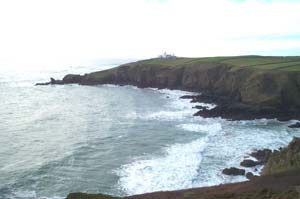
As you walk round the headland away from Housel Bay, you
will see the buildings (owned by The National Trust) used by
Marconi in his experiments to send a radio signal to The Isle
of Wight.. The path is an easy walk as it goes past the old Lloyds
Signal building towards Bass Point. Wave to the Coastguard (these
days a voluntary position) and follow the lane for a short while,
before you divert to the right, past Hot Point then on to Kilcobben
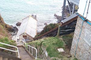
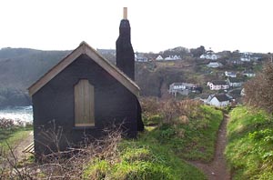
Cove and The Lifeboat Staion. This building is at the top of
the low cliff, and on first sight you'd think that the Lifeboat
has to descend a near-vertical drop! But as you walk round, you
can see that the men have a lift to go down to the Boathouse,
and it's this lift that is steep. A short walk further and you
decend to Church Cove: A lovely place, with thatched cottages
and lots of people in summer!
|
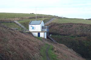
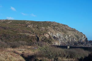
The
Lifeboat Station
|
|
|
Just up the road, turn right and return to the footpath:
Keep straight on, although you can divert to the right, where
there is a seat and nice views of Church Cove. Now the path gets
tougher, with a stiff climb upwards, then over a stile, with
a further upward climb until you pass a large shipping marker,
made of wood. After this, the path goes down a fairly steep little
valley, then just as steeply up the other side. You then gradually
continue along, with the end of this particular little bay, Carn
Barrow, getting nearer. Just as you're about to go right, you'll
see a path off to the left; take this path if you're following
the circular walk back to Lizard Village. Otherwise, follow the
path to the right, past the two small chalets and round the point
of Carn Barrow. Large rocks are to your left here; look over,
and it looks like an old quarry with a small, dirty pool in front.
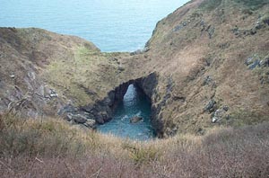
Further on, the path goes round to the left at Devil's Frying
Pan, a collapsed sea-cave. The path is near the edge here, so
be careful. Immediately after this, the path turns, and you'll
find yourself beside National Trust cottages just above the lovely
village of Cadgwith.
|
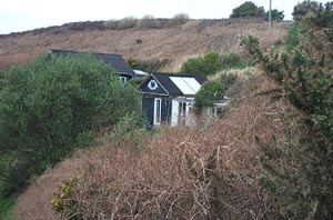
The
chalets at Carn Barrow
and
The Devil's Frying Pan
|
|
|
Following the Coastpath signs, you turn right and walk downhill
past cottages on both sides; turning off the tarmac road to stroll
through the pretty garden of a local guesthouse. It's really
nice here, with extensive views of Cadgwith and the beach. When
you reach the end of the garden, turn right; again following
the Coastpath sign. Looking over to the right, follow the path
of the little stream that you've just walked beside: You'll see
that it flows over the edge of the cliff; and from the other
side of Cadgwith, is seen to make a quite impressive waterfall.
Follow the signs and walk down to the road, then past the inn
and up the other side. You'll find that it's best to walk slowly
along this small strech of road, as there are very picturesque
views around here, and you may want to spend a few minutes looking
around; and if not, in the beer garden of the inn, gaining a
spot of liquid refreshment! When you're ready, carry on up the
hill, turning to the right. There are more pretty cottages here,
as you walk out of the village and towards the old lookout: Which
I think looks very similar in purpose to the famous Huers hut
at Newquay. After you turn the point at Kildown Point, the path
becomes very pleasant, passing through a couple of fields, then
a beside a stretch of coastline that seems to have slipped quite
a way down, though still accessible. Gradually, you're working
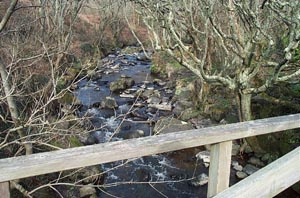
your way towards Carleon Cove, which is approached down a long
incline with cobbles along part of its length, then a bridge
over a very pretty stream.
|
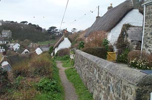
Cadgwith
|
|
|
As you walk out of Carleon Cove, follow the path round to
the right: Left takes you to the car park at Poltesco. You then
have a comfortable stroll around the side of a small cove, although
if it's a strong wind, you can get a bit buffeted here; as you
approach the rocks on the far side, follow the path up the side:
Both paths meet round the corner, but this way we found to be
easier. Soon, you come to a large caravan site: Holiday-makers
were happily playing pitch & putt when we came through, so
keep well against the hedge! After this, the path goes to the
right, with high hedges; take care to follow the right-hand path
as you walk along, otherwise you'll add a bit to your mileage.
You'll find yourself on tarmac road soon, be wary of cars on
their way down to Kennack Sands: It's narrow and twisting here,
and quite often drivers go a little too fast.
|
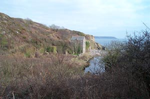
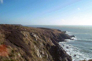
Carleon
Cove
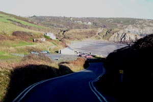
Going
down to Kennack Sands and the nasty climb at the other end |
|
|
As you approach the car park, you'll see a toilet block on
your left: As well as this being a good place to stop, there's
a path that you can follow, which is mainly for people with dogs,
but is also easier to walk along than the beach. It has some
nice pools and streams, while the beach is very difficult indeed:
OK for kids but not for hiking! At the far end of Kennack Sands,
you may have noticed a high cliff in front of you, You may have
hoped that the path doesn't actually go up this cliff. You are
out of luck! This cliff is one of the more strenuous along here,
partly because there's no real path: More a scramble over rocks,
and you will probably be out of breath when you get to the top:
Unless you are young or fit or both: In which case I'm jealous!
|
|
|
|
From here to Carrick Lûz is reasonable: No major descents
or climbs, one part I remember; you walk past the end of a garden,
but it's so unexpected to see cultivated plants out on the coastpath!
Soon you'll see the gate on your left that leads back to the
car; so walk through, keep the hedge to your left and walk to
the end of the field, where you'll find a track. Turn right,
and follow for some distance; through a gate, past a bungalow
and then you will see the car waiting patiently.
|
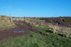
Carrick
Lûz and the gateway back to the car
|
|
|